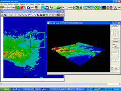
This is a 3D pic of Tunisia near where the 26th Infantry took off from during WWII on their Jihad against Hitler. Peter Guth, sometimes known as "The General" in GIS circles developed MicroDEM or Terraserver II it is closed source, but its implementation of OpenGL is awesome. ROCK ON PETER GUTH, ROCK ON BLUESPADERS!
Subscribe to:
Post Comments (Atom)

No comments:
Post a Comment